Build the bus map you actually want to drive.
Wayline Studio is a map editor for OMSI 2. It began as a fork of OMSI MapWorks because we wanted roundabouts that stay round, junctions that meet the road where you drew them, and British roads that aren't an afterthought. It's free, and it's still very much a work in progress.
A few things it's good at
The parts we spent the most time on, drawn out so you can see what each one does.
Roundabouts that stay round
Draw a road onto the ring and the whole roundabout is rebuilt with your new entry exactly where you clicked. Nothing gets cut into the ring, so there are no blobs and no kinks.
Want every exit in a particular spot? The roundabout editor lets you drag each one round the ring and point its arm down your road.
How joining a roundabout worksJunctions you can actually fine-tune
A T junction sits where you joined the road, and a crossroads is just a second road drawn onto the T. Move a junction and its roads come along with it.
Inside it, you choose which lane leads where, bend an AI path if buses keep clipping the kerb, and paint the markings.
Lanes and AI pathsStart from the real place
Put your map on the Earth, lay aerial photos over the tiles (Esri's need no key) and pull in terrain heights. In Great Britain you can use Ordnance Survey maps and Terrain 50 as well.
Then shape the ground with brushes, dig a river, or let it lay a tile's roads from OpenStreetMap as a starting point.
Satellite imagery and terrainAlso in the box
- Bus routes and timetablesPlace stops at the kerb, set departures and come back to edit them later.
- Your own road typesPut a road together lane by lane: bus lanes, cycle lanes, parking, pavements.
- Team CreateEdit one map with friends at the same time. Invite only, and still in testing.
- Objects and packsFences along curves, scattered trees, rows of lamps, and your own models from a zip.
- Ruler, saved views and snappingMeasure gradients, jump between places with Ctrl+1 to 9, place things on a grid.
- Height profilesSee how steep a road is along its whole length, and where it leaves the ground.
- A clear viewPress Tab and every panel gets out of the way while you work on the map.
- Map plansExport an SVG plan of your map with its lines and stops, to share or print.
Try the roundabout editor here
A small, browser-sized version of the real thing. In the editor, Apply builds the roundabout in OMSI, joins your roads to it and gives the ring priority.
- 1Click the ring to add an entry.
- 2Drag the teal dot to slide it round, and the amber dot to turn its arm.
- 3Double-click an entry to remove it. Put two too close together and they go red, same as in the editor.
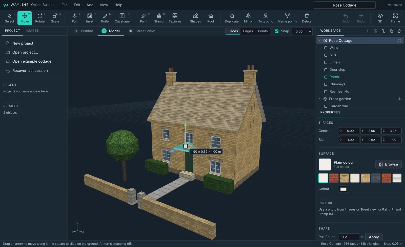
Wayline Object Builder
The buildings along your roads, made by you. Trace a house on the map, add a roof, cut in the windows, cover it in real British brick and slate or a photo from the street, then export it for OMSI 2 and Wayline Studio. No modelling experience needed.
- Trace from satellite imagery
- Drag tools, not numbers
- 55 built-in materials
- Low-poly export, one folder per object
Six stops from install to driving
One setup file, no admin rights.
Any OMSI 2 map, or a new one.
Junctions build themselves.
Join them, or place every exit.
Stops, timetables, AI paths.
A separate map folder for OMSI.
Build it with your mates
Share an invite code and work on the same map at once. You see each other as coloured markers with names, and you can watch roads appear as they're drawn. Changes reach everyone in about a second.
The owner can kick, ban or change the code at any time. Passwords are only ever stored hashed.
2.13.1: Opens and builds again
- Fixed the compile error that stopped 2.13 opening and building: two parts of the road tools defined the same helper.
- The empty asset folders are back in the source, so Unity no longer warns about missing folders.
Stuck on something?
There's a guide for every tool, a long FAQ and a troubleshooting section. Search the lot from here.